Plan, Preserve, Play
Niobrara River Area
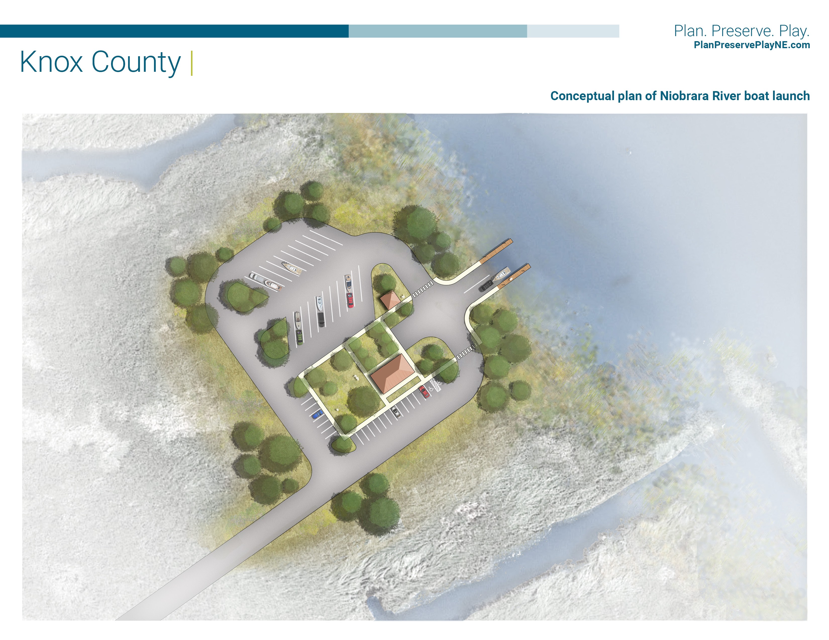
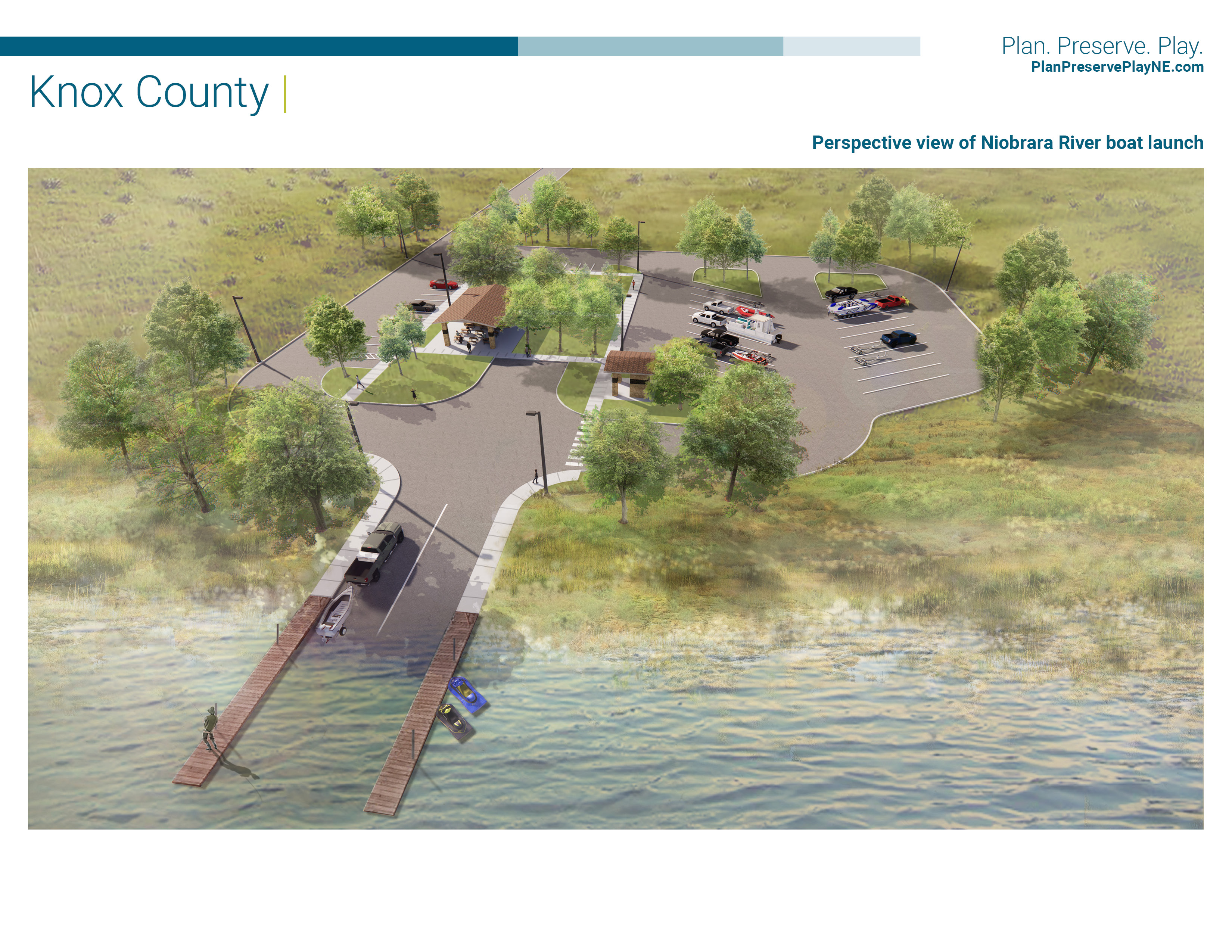
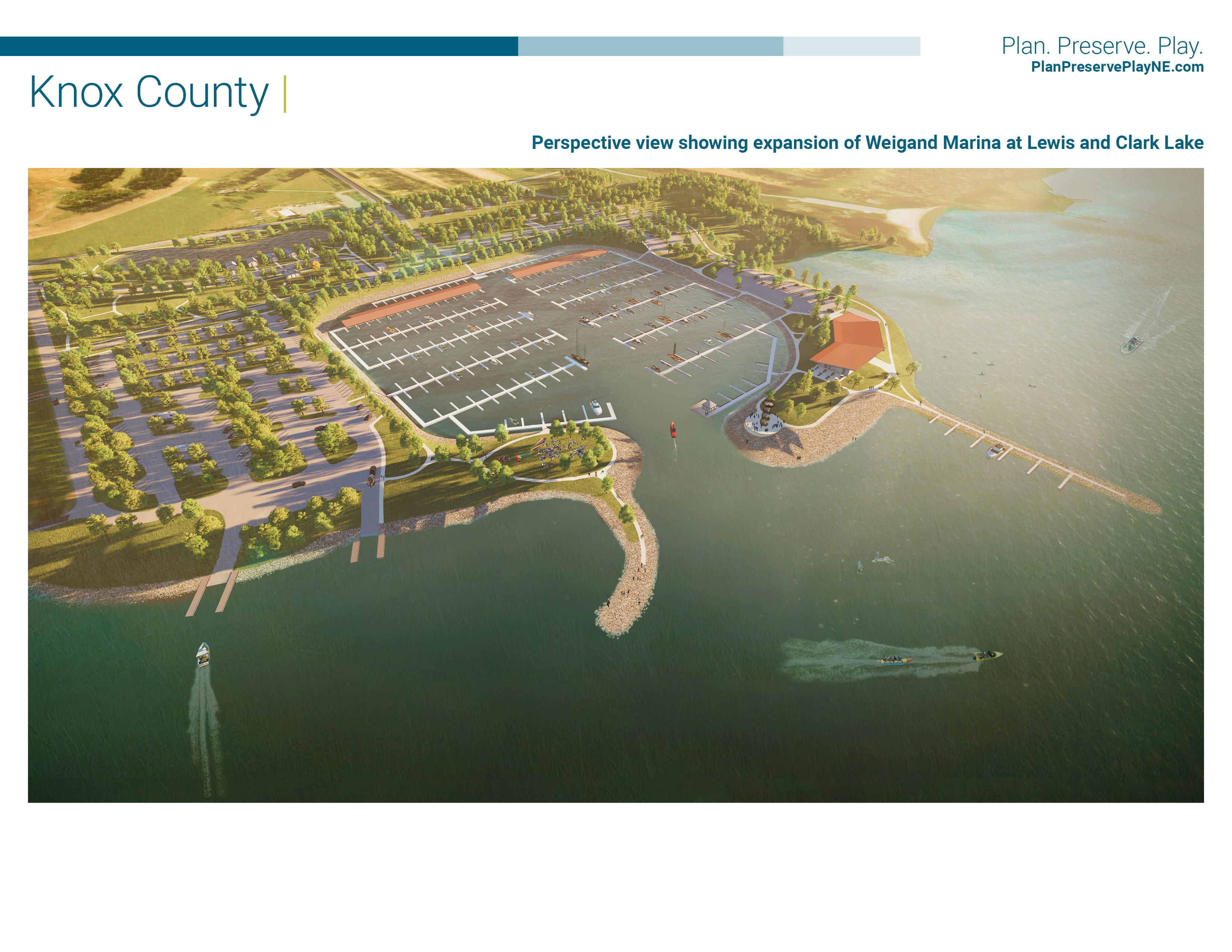
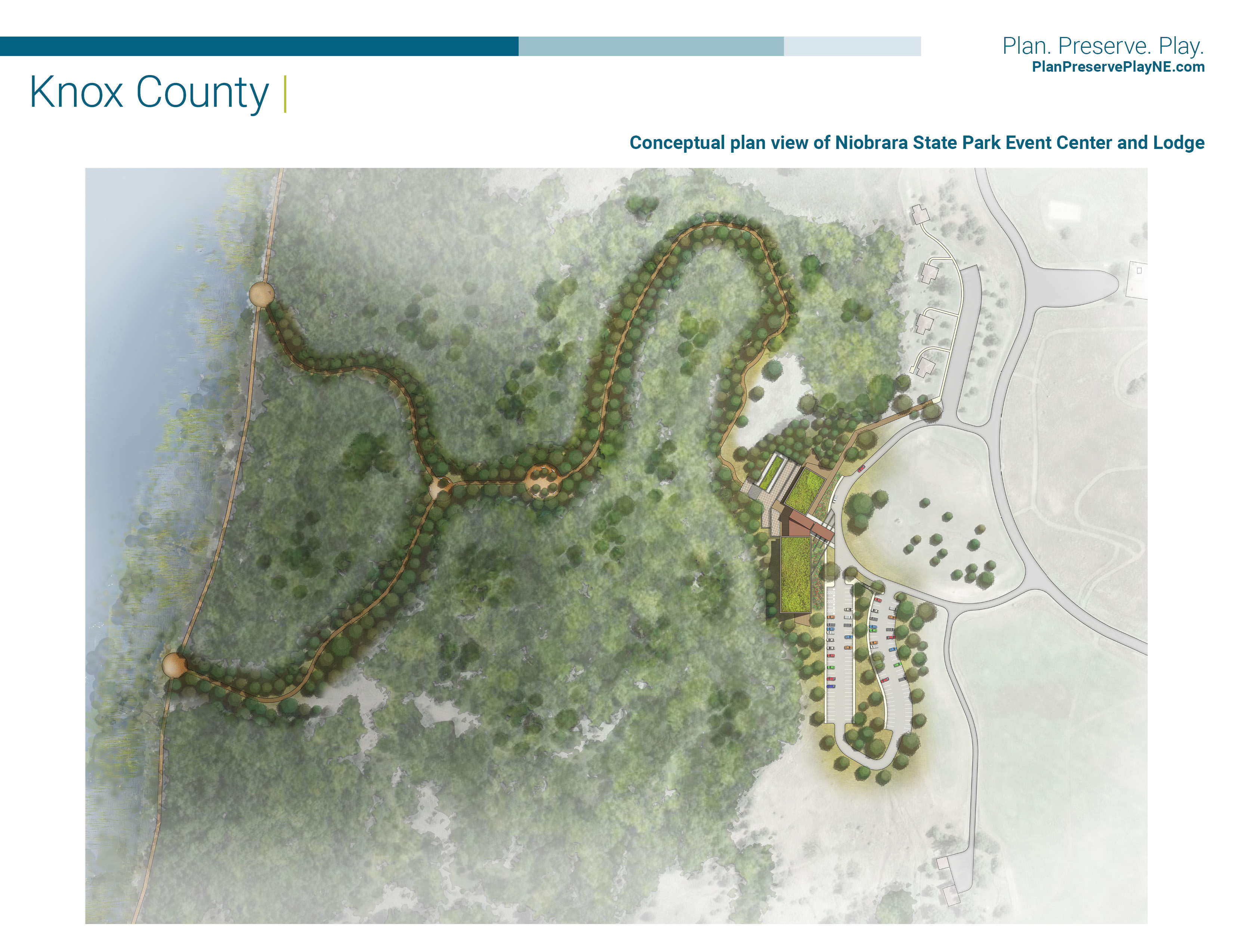
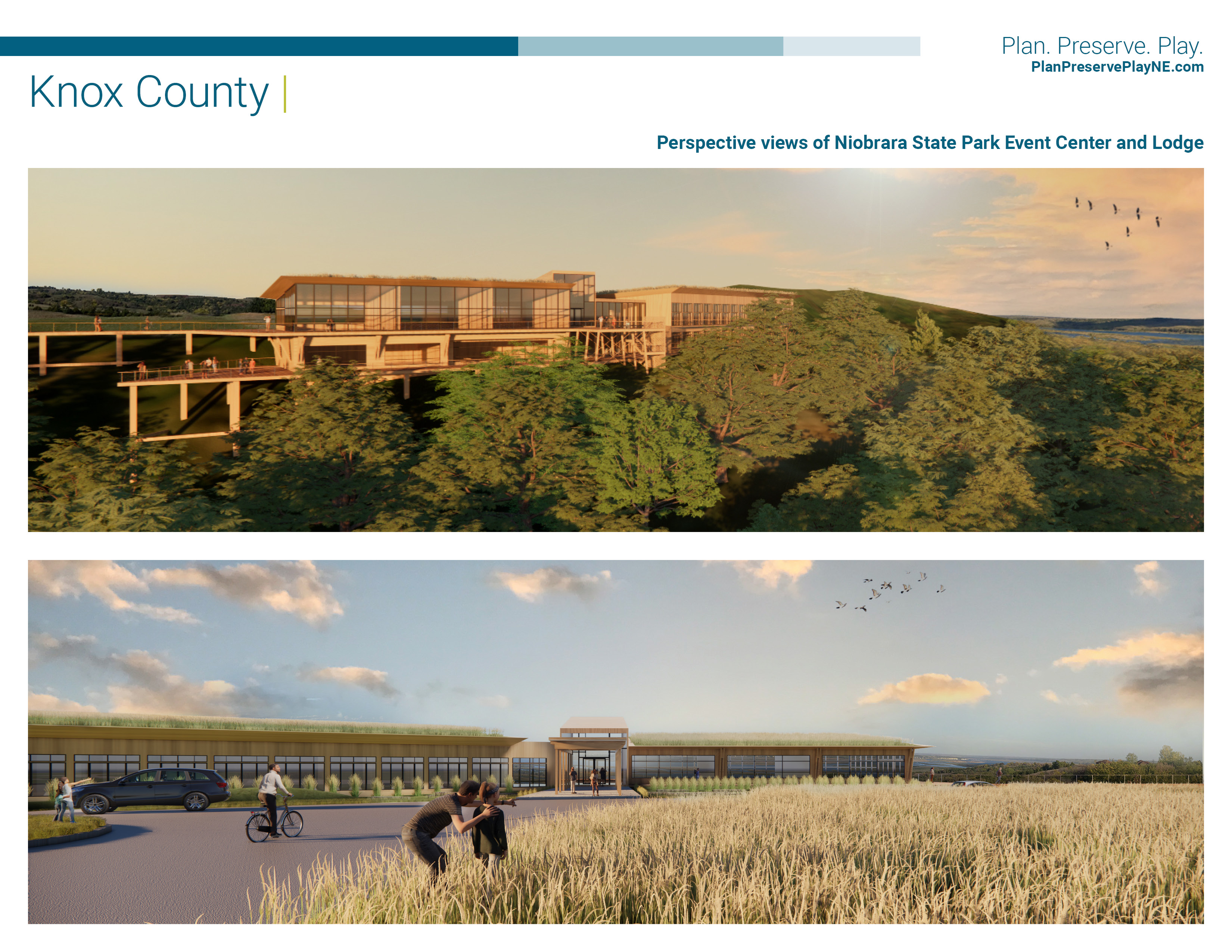
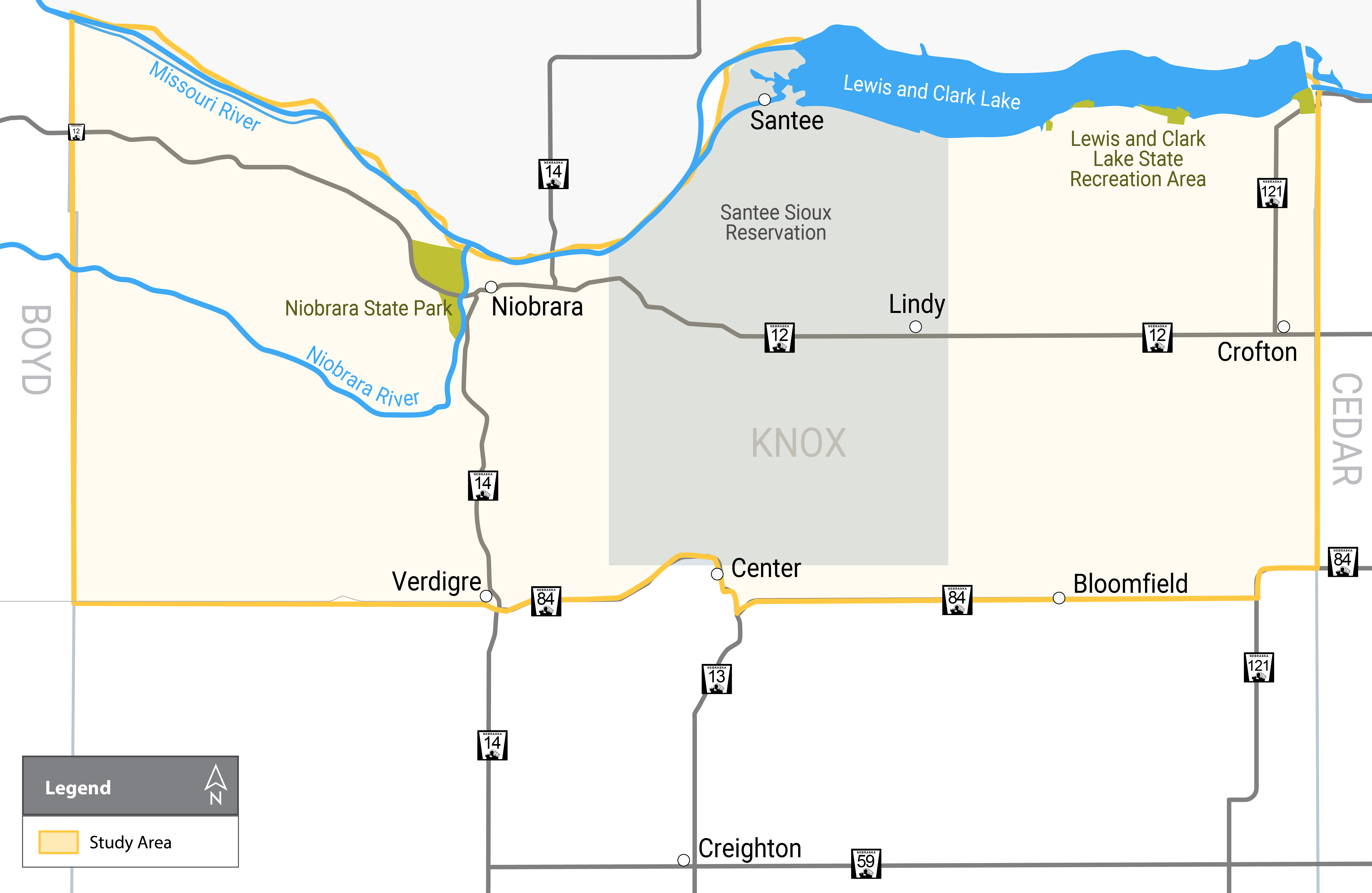
Situated at the confluence of the Niobrara and Missouri rivers on Nebraska’s northeastern border, Niobrara State Park offers cabins, camping, picnicking, swimming, boat ramps, horseback trails, hiking, fishing and wildlife watching opportunities. To the east of Niobrara State Park, the Lewis and Clark Lake State Recreation Area offers modern cabins, boating, fishing and hunting opportunities. This plan will identify potential recreational and other development improvements to build on what the region currently offers. The study will define the economic benefits of proposed development on local, regional and statewide tourism with the ultimate goal of increasing population, jobs and per capita income.
Lower Niobrara Design Workshop Presentations
Schedule