Plan, Preserve, Play

Skip to main content

Plan, Preserve, Play
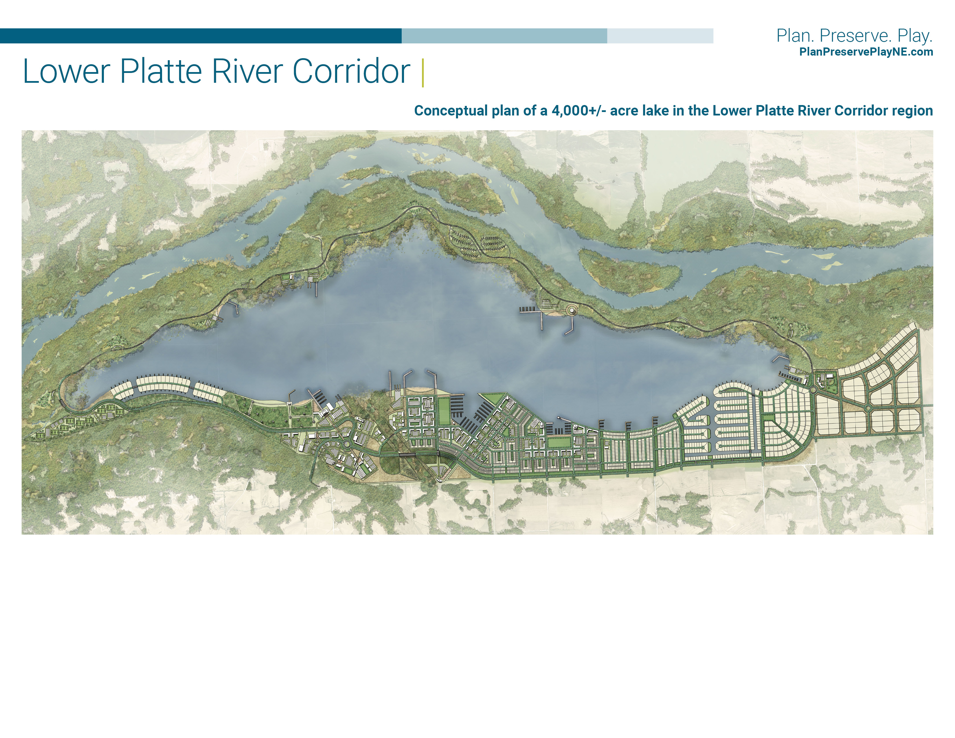
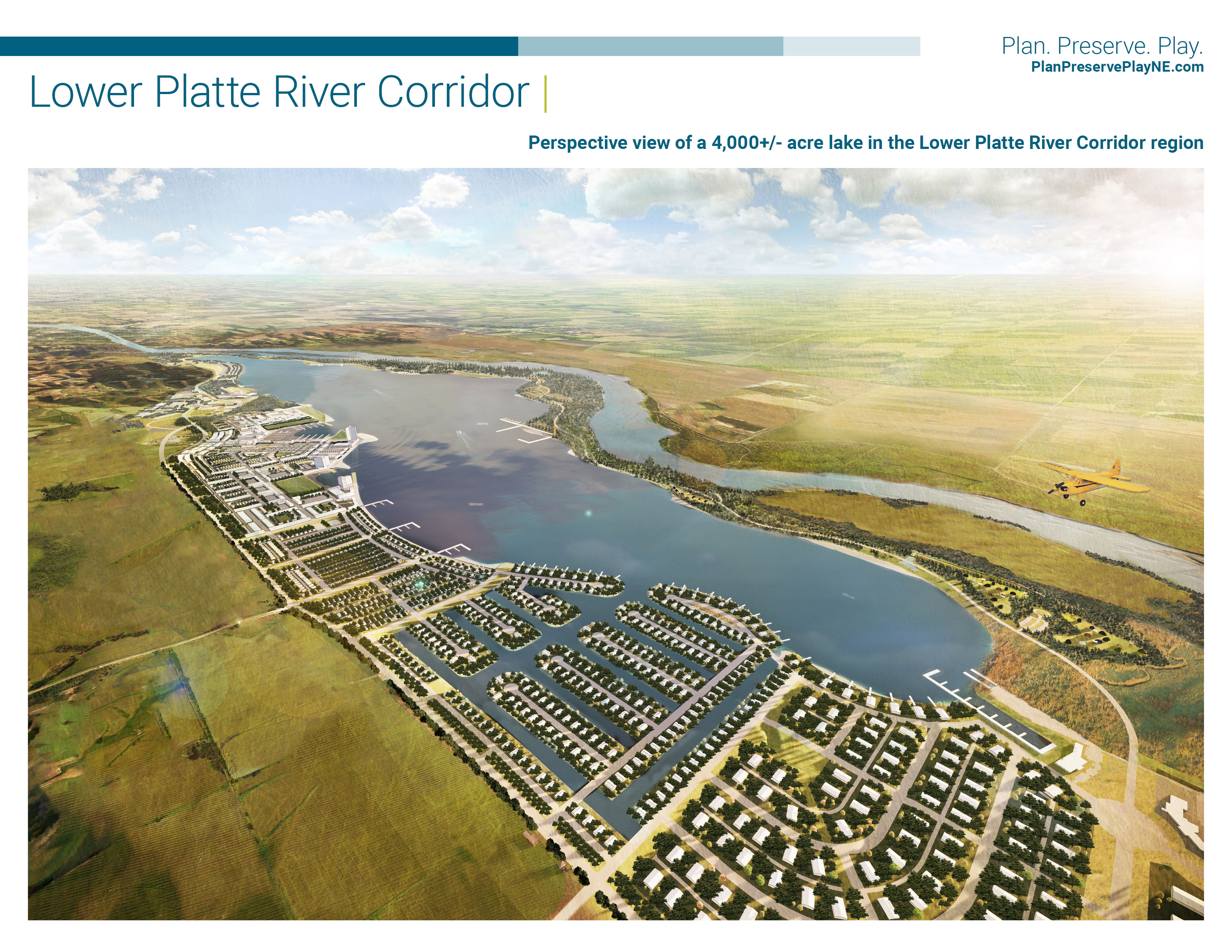
Lower Platte River Area

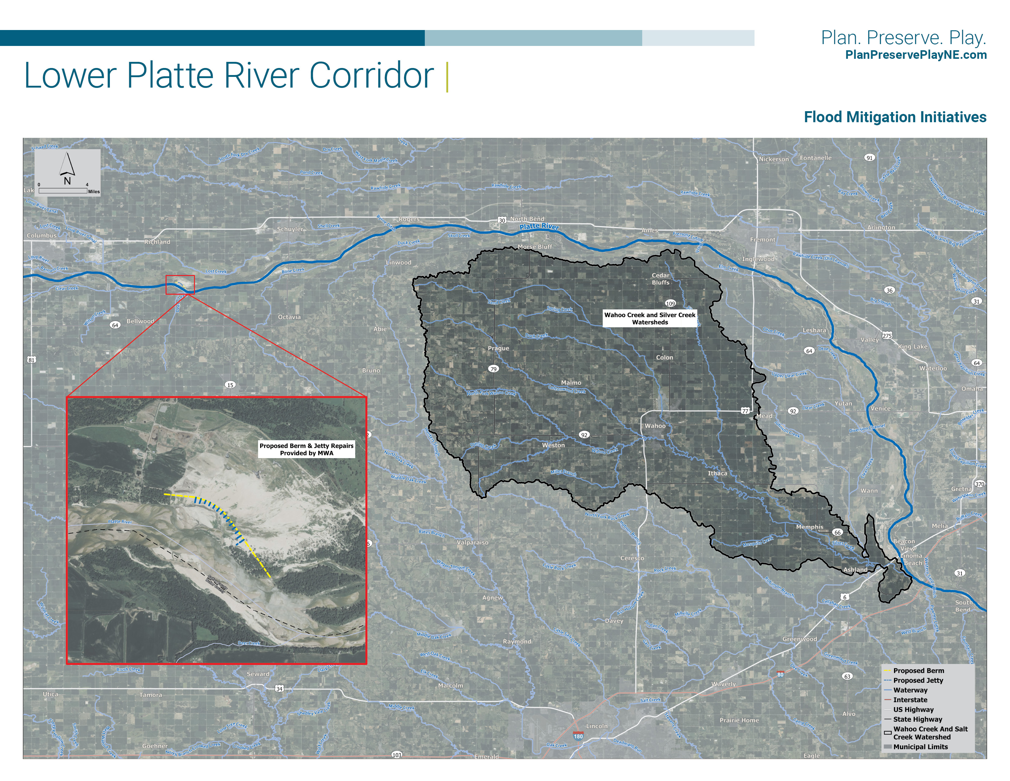
This study will focus on providing flood protection to public and private property within the Lower Platte River corridor, defined as the reach of the Platte River from Columbus to Plattsmouth, Nebraska. While flood protection is the primary goal of this study, it will also explore opportunities to maximize recreational opportunities and tourism, available water supply, improved water quality and habitat preservation. Study recommendations will include measures that protect public and private property, enhance economic development, and promote private investment to create jobs along the Platte River corridor.
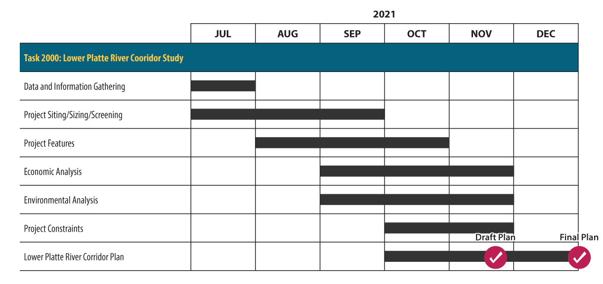

A map of the study scope, which spans the length of the Platte River from Columbus to Plattsmouth, Nebraska. The map includes counties and major cities in the study area, including Columbus, Fremont, Omaha, Papillion, Ashland, Louisville and Plattsmouth. Some Nebraska State Parks and State Recreation Areas are also highlighted on the map, including Mahoney State Park, Platte River State Park, Schramm Park State Recreation Area, Louisville State Recreation Area, Two Rivers State Recreation Area and Fremont Lakes State Recreation Area.

Schedule

A graphic showing the general schedule for the LB 406 study of the Lower Platte River Region. It shows that data and information gathering will occur in July, project siting, sizing and screening will occur from July to September, project features will occur from August to October, an economic analysis and environmental analysis will occur from September through November, a study of the project constraints will occur from October to November, and the final plan will be complete in December.